AI TOOL PROFILE
Navigine: Indoor Positioning and Wayfinding Software

- Data and Analytics
- Location Services
- Warehouse and logistics managers
- Healthcare facility operators
- Retail chain operators
- Mobile app developers
- System integrators
Pricing
Pricing for the platform was not clearly available from the provided evidence. Bluetooth LE beacons are listed at approximately $15 to $25 each. A 14-day free trial of the RTLS platform is available.
At a glance
- Best for
- Warehouse and logistics managers, Healthcare facility operators, Retail chain operators, Mobile app developers, System integrators
- Key use cases
- Asset and Equipment Tracking, Visitor Wayfinding, Staff Safety and Workflow Monitoring, Location-Based Marketing
- Official website
- Visit navigine official website
How AI is used
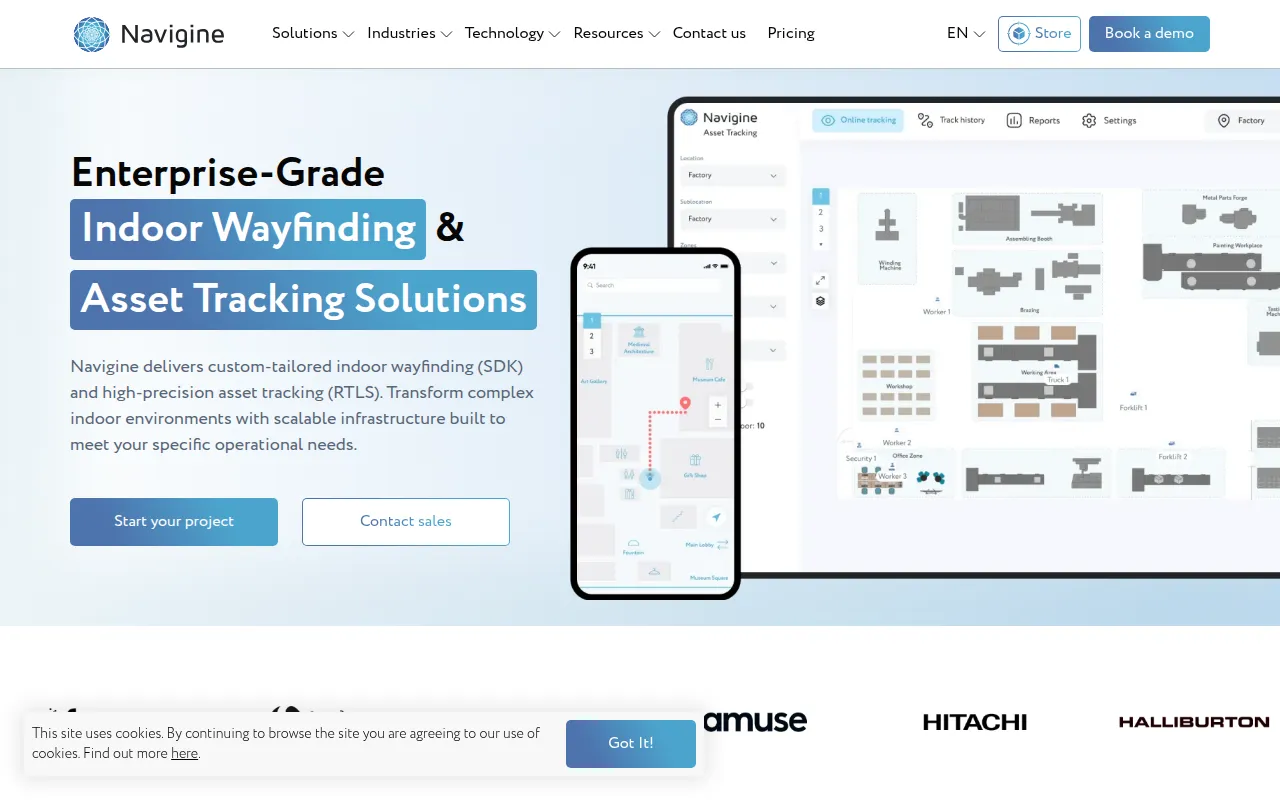
Navigine is an indoor positioning and localization platform that uses Bluetooth Low Energy (BLE), Ultra-Wideband (UWB), and Wi-Fi to track objects and people. The platform consists of two primary offerings: a tracking platform for asset monitoring and an SDK for developers integrating indoor navigation into iOS and Android apps.
The software is designed for businesses operating large-scale facilities, such as warehouses, hospitals, and shopping malls. It supports various levels of accuracy, from general proximity to sub-meter precision, depending on the hardware used.
Buyers should confirm hardware requirements, as the system relies on the installation of physical beacons or antennas throughout the facility. Implementation of the SDK into existing mobile applications may require technical expertise from a developer or system integrator.
Key Features
Wayfinding SDK
Supports the integration of turn-by-turn indoor navigation, point-of-interest search, and floor plan visualization into mobile apps.
Real-Time Location System (RTLS)
A tracking platform designed to monitor the movement of assets, personnel, and vehicles in real time.
Multi-Technology Support
Supports BLE, UWB, and Wi-Fi signals to provide positioning accuracy ranging from 30 cm to 5 meters.
Indoor Analytics
Provides reporting on visitor behavior, foot traffic, and dwell-time analytics.
Geofencing
Supports the creation of virtual safety zones and location-based push notifications.
Use Cases
Asset and Equipment Tracking
Monitoring the location of forklifts, medical equipment, or pallets in warehouses and hospitals to help reduce search time.
Visitor Wayfinding
Providing step-by-step navigation for customers in shopping malls or patients in large medical centers.
Staff Safety and Workflow Monitoring
Tracking personnel in industrial zones to support safety compliance and operational coordination.
Location-Based Marketing
Sending targeted push notifications to retail customers as they approach specific product zones.
FAQ
How does Navigine work without GPS?
- Navigine uses a network of physical beacons or antennas (BLE, UWB, or Wi-Fi) installed in a building to calculate coordinates of people or assets.
What is the typical accuracy of the system?
- Accuracy varies by technology: BLE typically provides 1-5 meter accuracy, while UWB can provide positioning down to 30 cm.
Do I need to build my own app to use Navigine?
- While Navigine provides an SDK for custom app development, they also offer a demo app and a web-based tracking platform for asset monitoring.
Source category: Data & Analytics
Source subcategory: Location Services
More tools in Data & Analytics
Other published listings in the Data & Analytics category.
More tools in the Location Services software type
Related listings that share the same software type for comparison and shortlisting.