AI TOOL PROFILE
farmlab: Soil Moisture Prediction Software

- Other
- Agricultural Software
- Farmers
- Agronomists
- Agribusinesses
- Enterprise land managers
Pricing
Beta access is currently free. Post-beta, a tiered pricing model based on hectares managed is planned.
At a glance
- Best for
- Farmers, Agronomists, Agribusinesses, Enterprise land managers
- Key use cases
- Irrigation Scheduling, Early Crop Stress Detection, Large-Scale Land Management, Compliance Tracking
- Official website
- Visit farmlab official website
How AI is used
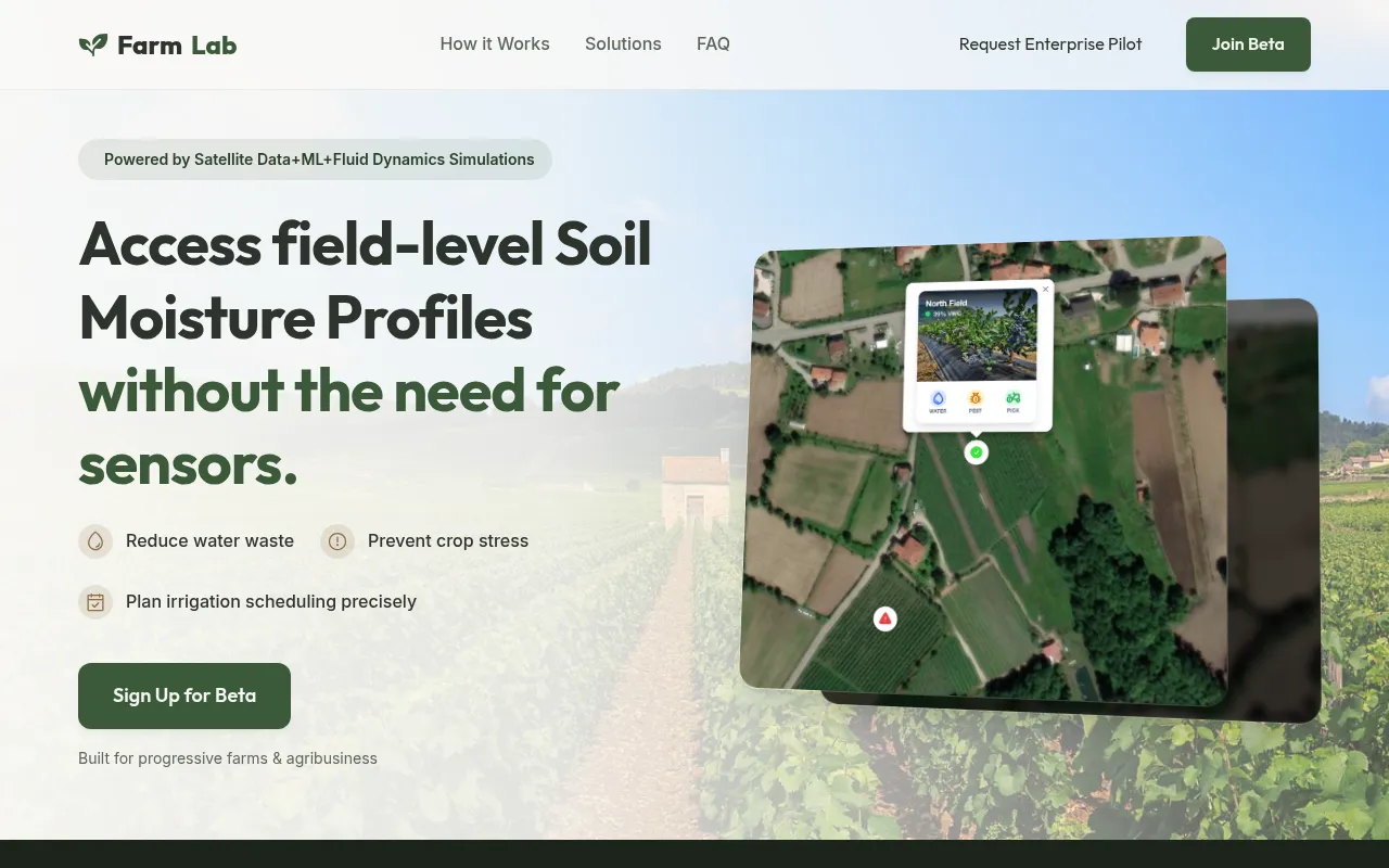
farmlab is a remote-sensing platform designed to provide soil moisture profiles by combining satellite observations with machine learning and fluid dynamics simulations. It generates high-resolution maps and moisture trends to help users make decisions about irrigation and resource management.
The tool is intended for a range of users, from individual farmers and agronomists to large-scale agribusinesses and enterprises. It supports various scales, from a single field to global portfolios, and includes role-based access for larger teams.
By using data from multiple satellites and local weather and topography priors, the platform provides early warnings for crop stress and irrigation alerts. Because it is remote-sensed, there is no hardware to install or maintain on-site.
Buyers should note that the platform is currently in a closed beta. They should also consider that while it supports most broadacre and orchard crops, very dense canopies may rely more on physics and weather interpolation than direct radar data.
Key Features
Satellite-Based Moisture Mapping
Generates soil moisture maps at 50 to 100 meters using data from satellites including Sentinel-1, Modis, and SMAP.
7-Day Moisture Trends
Provides a week-long view of moisture levels to help with irrigation planning.
Crop Stress and Irrigation Alerts
Delivers warnings when crops may be under stress or when irrigation is needed.
Physics-Based Interpolation
Uses fluid dynamics simulations to interpolate daily soil states between satellite overpasses.
Global Portfolio Monitoring
Includes dashboard tools designed for monitoring thousands of hectares across different regions.
Automated Compliance Reporting
Supports the generation of reports for regulatory or operational compliance.
Use Cases
Irrigation Scheduling
Using moisture maps and 7-day trends to plan when and where to apply water.
Early Crop Stress Detection
Monitoring for signs of water stress to intervene before crop yields are affected.
Large-Scale Land Management
Monitoring soil moisture across thousands of hectares through a centralized dashboard.
Compliance Tracking
Generating automated reports to document water usage and soil conditions for compliance.
FAQ
Do I need to install hardware to use farmlab?
- No, farmlab is remote-sensed and does not require physical soil sensors in the ground to function.
How accurate are the moisture predictions?
- The models typically achieve a 3-5% volumetric water content margin of error, though this can vary based on soil type and crop canopy density.
What is the cost of using farmlab?
- Access is currently free during the closed beta period. Following the beta, tiered pricing based on the number of hectares managed will be introduced.
Source category: Other
Source subcategory: Agricultural Software
More tools in Other
Other published listings in the Other category.
More tools in the Agricultural Software software type
Related listings that share the same software type for comparison and shortlisting.