AI TOOL PROFILE
Mapme: No-Code Interactive Map Builder

- Marketing
- Website Builder
- Small businesses
- Marketing agencies
- Nonprofit organizations
- Mid-market companies
Pricing
Paid plans start at $30/month or $360/year. Higher tiers include Professional ($55/mo) and Expert ($110/mo), with custom pricing available for Enterprise.
At a glance
- Best for
- Small businesses, Marketing agencies, Nonprofit organizations, Mid-market companies
- Key use cases
- Project Portfolios, Campus and Facility Navigation, Event Management, Real Estate Listings, City and Tourism Guides
- Integrations
- Google Sheets, Excel import, CSV import, Google Analytics, Google Forms
- Official website
- Visit Mapme official website
How AI is used
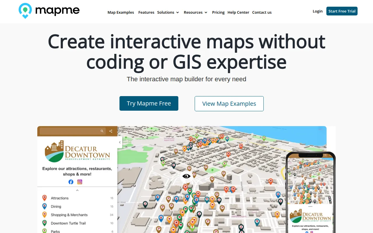
Mapme is a tool for creating interactive maps without requiring GIS expertise or coding knowledge. It supports plotting locations and adding media such as photos, videos, and 3D tours, which can be embedded into websites or shared on social media.
The platform is designed for a variety of users, including marketing agencies, real estate professionals, and nonprofit organizations. It supports tasks such as visualizing project portfolios, managing event layouts, or creating city guides.
Buyers should confirm that the specific pricing tier meets their requirements for location limits and feature sets, such as data import and team collaboration. Users may also verify if the available map resolution options meet their specific print requirements.
Key Features
Data Import and Sync
Supports importing locations via CSV and Excel files, and includes a Google Sheets sync feature for updates.
Media Attachments
Supports adding photos, videos, audio files, PDFs, and Matterport 3D tours to map locations.
Map Customization
Includes 3D building displays, custom marker styling, and various map styles including satellite view.
Search and Filtering
Includes keyword search boxes, category legends, and multi-select filters to help users find locations.
Navigation Tools
Provides walking directions, a GPS-based 'show my location' feature, and links to external navigation apps.
Analytics and Tracking
Integrates with Google Analytics to track map views, category clicks, and conversion rates on call-to-action buttons.
AI Import Assistant
Designed to automatically identify and map fields from imported location data files.
Use Cases
Project Portfolios
Visualizing construction or architecture projects by location.
Campus and Facility Navigation
Helping visitors navigate university campuses or corporate sites via interactive guides.
Event Management
Mapping vendor locations, schedules, and walking paths for festivals or conferences.
Real Estate Listings
Showing available property units, amenities, and surrounding points of interest.
City and Tourism Guides
Creating discovery maps for local businesses, attractions, and public services.
Safety and Security Mapping
Visualizing emergency access points, evacuation zones, and facility layouts for security teams.
Integrations
- Google Sheets
- Excel import
- CSV import
- Google Analytics
- Google Forms
- JotForm
FAQ
Does Mapme require coding knowledge?
- No, the platform is a no-code builder that does not require GIS or programming expertise.
Can Mapme maps be used on mobile devices?
- Yes, the maps are responsive and designed for a mobile experience without requiring a separate app.
What are the limits on the free trial?
- The 14-day free trial allows for a maximum of 5 locations and 100 map views.
Can I embed these maps on my own website?
- Yes, subscription plans allow maps to be embedded on websites using platforms such as WordPress, Wix, and Squarespace.
Source category: Marketing
Source subcategory: Website Builder
More tools in Marketing
Other published listings in the Marketing category.


More tools in the Website Builder software type
Related listings that share the same software type for comparison and shortlisting.


